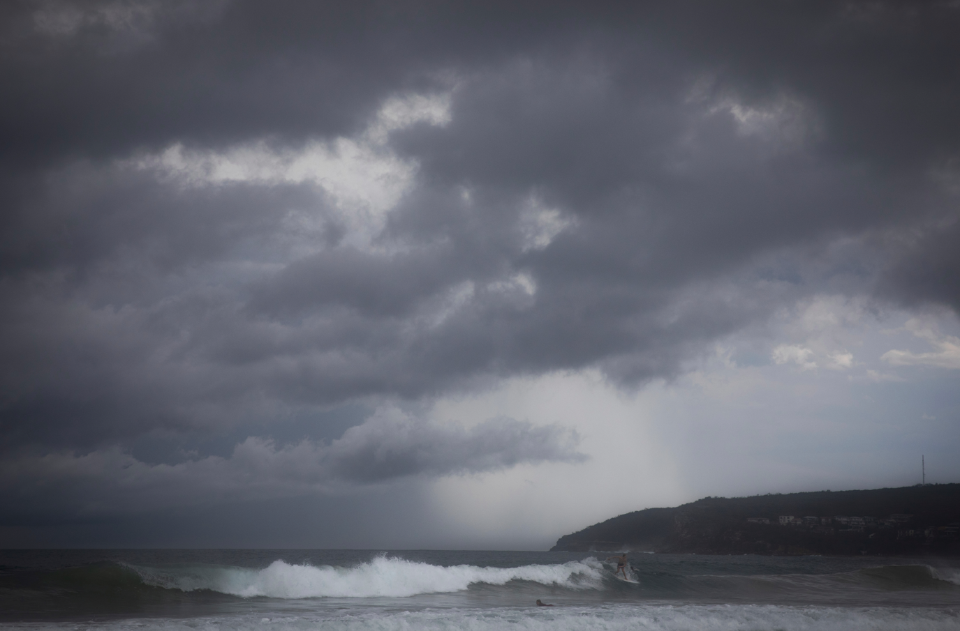
A week of heavy rain, damaging winds and potentially severe thunderstorms is on the way for residents in south-eastern New South Wales, prompting authorities to issue a warning about the risk of flash flooding.
Thunderstorms are expected from today across parts of Sydney, the Illawarra region, the Hunter region and the NSW South Coast.
The NSW SES has warned some storms could bring 30mm to 60mm of rain an hour, gusty winds exceeding 90km/h and large hail.
READ MORE: 'Leave now': Residents issued flood evacuation order
READ MORE: Victorian premier heckled while announcing further $15m of support after fires
From tomorrow and across the weekend, the rain could become more widespread across the Illawarra, Shoalhaven and South Coast, as a low pressure system develops off the coast.
This could cause rivers and creeks to rise quickly, which could cover roads in water in some areas.
NSW SES state duty commander Dallas Burnes said while rainfall totals may build gradually, conditions could change quickly.
"Even moderate rain over several days can cause problems, especially when it falls on already wet ground," Burnes said.
"We are working closely with the Bureau of Meteorology to monitor this system and our members across south eastern NSW have been briefed and are ready to respond."
READ MORE: 'This is my yard': Queensland town records wettest day in 110 years
READ MORE: Renewed calls for number plates on e-bikes following several crashes
Burnes urged people to prepare early and be mindful of the increased risks
"We ask people to be vigilant if camping near creeks and rivers and to make sure you have appropriate equipment as it might be raining for up to a week in some areas," he said.
"If water levels begin to rise, move to higher ground immediately."
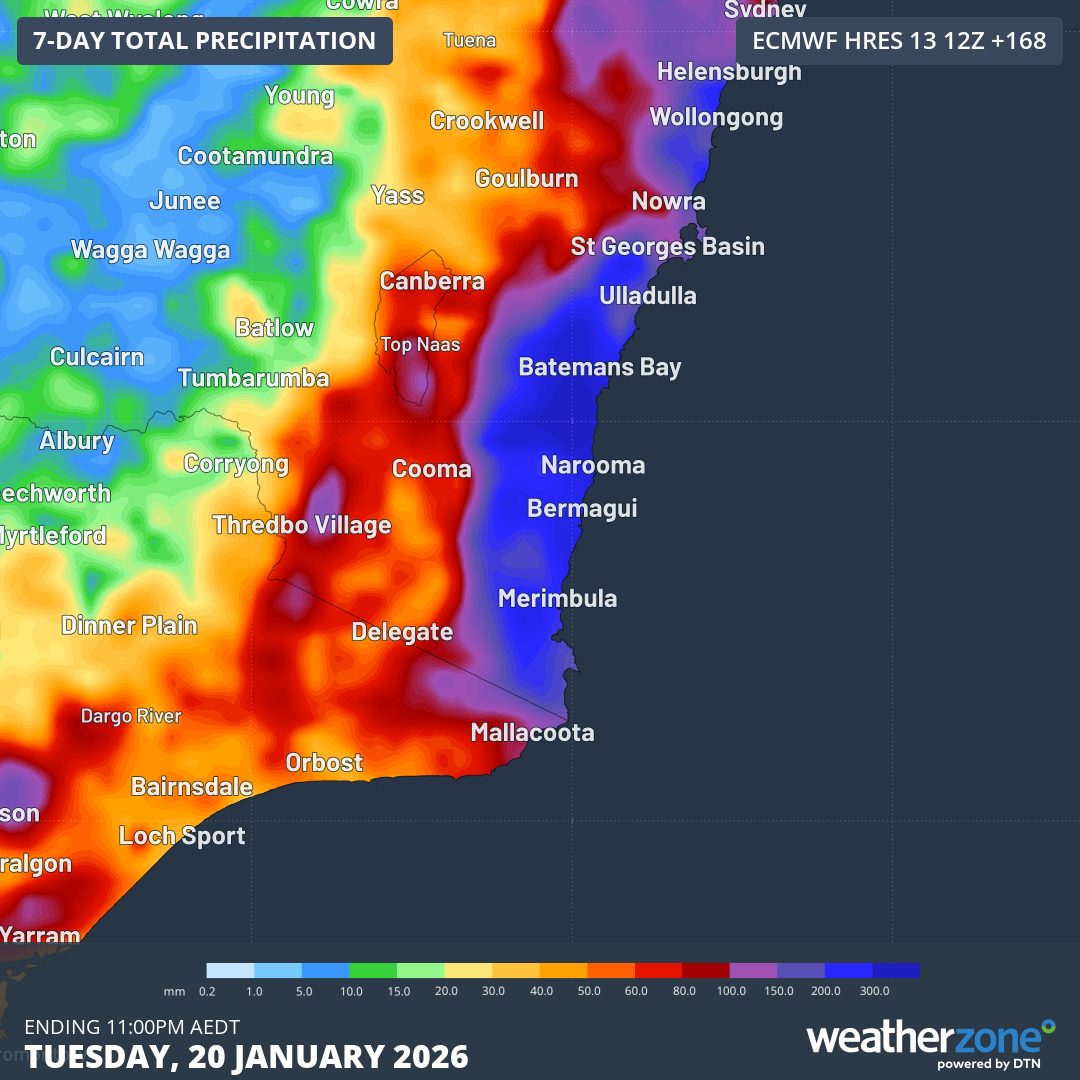
The rain comes after ex-Tropical Cyclone Koji lashed Queensland, where the town of Clermont near Rockhampton had its wettest day in more than 110 years earlier this week.
"The broad low pressure trough is extending from ex-TC Koji in the north all the way down to central Victoria,"
Weatherzone meteorologist Joel Pippard said the broad low pressure trough had extended from the ex-tropical cyclone in the north all the way down to central Victoria.
"The trough will meet up with an upper trough and cold pool from today," Pippard said.
"As the system tracks west, bringing scattered to widespread thunderstorms on Thursday, it will spawn a coastal trough off the NSW coast.
"The moisture feed from the tropics and the Tasman Sea will deliver heavy rainfall along the NSW coast, heaviest in the far south, with a growing powerful swell to impact the coast from Friday to next Tuesday."
Residents in parts of Victoria can also expect potential storms and showers tomorrow as the low pressure trough moves over the country's south-east, drawing moisture from the Coral Sea in Queensland.
"That moisture will wrap into NSW and south-eastern Victoria, with potentially some rain for Melbourne," Weatherzone meteorologist Felix Levesque predicted yesterday.
"The most likely total is in the 1-5 mm range with heavier stuff further east and south into Bass Strait.
"But potentially, Melbourne could see 10-20 mm depending on the depth of the moisture feed."
DOWNLOAD THE 9NEWS APP: Stay across all the latest in breaking news, sport, politics and the weather via our news app and get notifications sent straight to your smartphone. Available on the Apple App Store and Google Play.